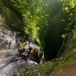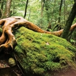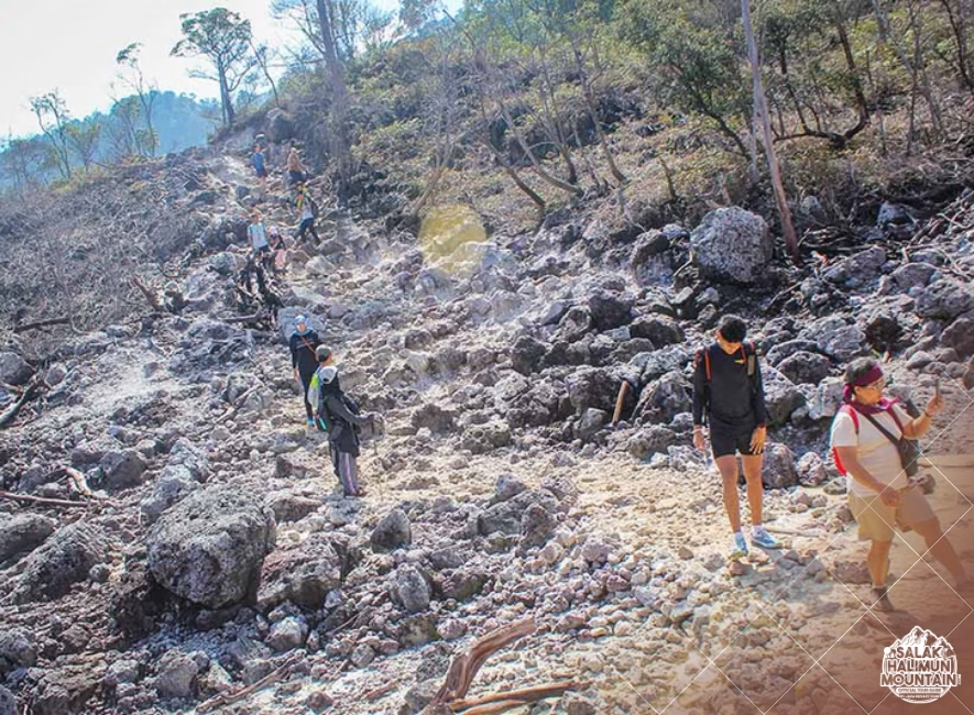
salakhalimunmountain.com – Trekking through the sprawling rainforest expanse of Mount Halimun Salak National Park presents a terrain defined by raw, untamed density. Beneath the towering canopy of ancient montane trees, the understory explodes with thick bamboo brakes, tangled rattan palms, wild banana stands, and dense fern thickets. In this lush green interior, traditional distance estimation quickly breaks down. Standard paces shrink, visual horizons collapse to a few meters, and time seems to stretch. In conditions like these, tracking your pace in dense Halimun undergrowth becomes a fundamental land navigation skill to accurately measure distance, manage energy, and maintain schedule control.
On clear, well-graded trails, estimating distance by time or counting steps is straightforward. However, when wading through knee-deep mud, ducking under arching bamboo, or scrambling over mossy root webs, your stride length becomes wildly inconsistent. What feels like two kilometers of exhausting effort might only be six hundred meters on a map. Mastering specialized pacing techniques adapted for tropical jungle undergrowth prevents costly navigational errors, ensures timely arrivals at camp, and keeps your backcountry route completely on track.
The Reality of Jungle Pace Disruption
To accurately measure distance in dense rainforest environments, you must first understand how tropical undergrowth alters human movement. Standard land navigation relies on a baseline pace count—the number of double steps (every time your left foot hits the ground) required to cover 100 meters on flat, open terrain. For most adults, a flat-ground pace count averages between 60 to 65 double steps.
In the thick undergrowth of Halimun Salak, that baseline changes dramatically. Tangled roots force shorter steps, steep mud inclines require high-knee climbing, and low-hanging vegetation forces frequent pauses or crawling. On a dense, off-trail ridge shoulder or choked valley floor, your pace count can easily double or triple—requiring 120 to 180 double steps to cover the exact same 100-meter distance. Relying on open-terrain pace estimates in deep jungle lead directly to overestimating progress and missing key trail junctions.
Establishing Your Tropical Jungle Pace Count
Before relying on pacing for navigation, you must calibrate your pace count specifically for jungle conditions. Find a measured 100-meter stretch of overgrown, sloped forest terrain near a trail base or camp.
Walk the stretch at your normal, sustainable trekking cadence while wearing your full backpack. Count every double step (counting 1 every time your dominant foot strikes). Repeat the walk three times—upslope, downslope, and across wet roots—and average the results. Having a calibrated “jungle pace count” gives you a realistic mathematical foundation for measuring ground distance under dense foliage.
Tools and Methods for Counting Paces in Thick Bush
Keeping an accurate count of hundreds of steps while simultaneously pushing through thorny vines, checking your compass, and watching your footing is mentally exhausting. Without a physical tracking system, mental counts are quickly lost to distraction.
The most reliable manual tool for tracking distance in dense terrain is a set of pace count beads, often called ranger beads. Suspended from a lanyard on your backpack strap, ranger beads consist of 13 beads divided into two sections by a knot: 9 beads on the bottom section and 4 beads on the top section.
How to Operate Ranger Beads in the Field
Every time you complete your calibrated jungle pace count (for example, 130 double steps in thick undergrowth), slide one bead from the bottom section down. Each bottom bead represents 100 meters traveled.
When all 9 bottom beads are pulled down and you complete another 100 meters (reaching 1,000 meters or 1 kilometer), slide the 4 top beads down to mark 1 kilometer, reset the bottom 9 beads to the top position, and continue counting. This tactile system operates entirely by feel, requiring no mental memory or battery power, making it completely foolproof in heavy rain or dense brush.
Adapting Pacing for Variable Halimun Topography
Jungle undergrowth is rarely flat. Mount Halimun’s topography is a chaotic landscape of steep volcanic spurs, deep ravines, and muddy river terraces. To maintain accuracy, you must dynamically adjust your pace count based on terrain slope and vegetation type.
When climbing steep, muddy slopes, your stride shortens significantly, increasing your pace count. A good rule of thumb is to add 10% to 20% to your pace count for every 10 degrees of slope incline. Conversely, when navigating tangled bamboo thickets where horizontal clearance is blocked, step frequency increases while forward movement slows. Recognizing these terrain modifiers allows you to adjust your bead pulls so your map plotting remains accurate.
Accounting for Obstacle Bypasses and Micro-Detours
In dense undergrowth, walking in a perfectly straight line is nearly impossible. Fallen giant trees, landslide scars, and dense rattan patches force constant micro-detours around obstacles.
If you take five steps to the left to bypass a massive fallen tree trunk and five steps back to the right to regain your heading, those sideways steps add to your physical count without advancing you toward your target coordinate. When executing micro-detours, pause your step count during lateral movement, or estimate the net forward progress made along your compass bearing rather than counting every zig-zag step.
Combining Pace Tracking with Time-Distance Estimation
Pacing by step count works exceptionally well over short to medium distances, such as tracking a 500-meter leg toward a river confluence. For long, multi-kilometer legs through dense undergrowth, combining step counting with time-based tracking provides a robust dual-verification system.
In dense Halimun undergrowth, realistic trekking speeds range between 0.8 to 1.5 kilometers per hour depending on pack weight and vegetation density. Calculate your estimated time of arrival (ETA) for a specific trail leg using your known speed baseline (e.g., 1 km/h in dense brush). Check your watch against your ranger beads every 30 minutes. If your watch indicates 45 minutes have passed but your beads show only 300 meters covered, you know terrain density has slowed your rate of advance, allowing you to recalculate your daylight budget before camp.
Setting Time Bounds for Trail Checks
Using time as a pacing boundary prevents getting hopelessly lost when searching for faint trails or hidden landmarks in thick vegetation. This is known as setting a “time limit on search.”
If your map indicates a major trail junction or river crossing is 400 meters ahead through thick understory, calculate the maximum time needed to cover that distance (e.g., 25 minutes at jungle pace). If you have walked for 30 minutes without finding the junction, stop immediately. Continuing forward beyond your calculated time limit means you have either missed the feature or drifted off-course. Stop, assess your surroundings, re-verify your compass bearing, and check your map position.
Rest Management and Physical Cadence
Pace tracking is deeply tied to physical energy management. Pushing through thick undergrowth causes rapid fatigue, leading to sloppy footwork, erratic step lengths, and mental errors in counting.
Maintain a steady, rhythmic “jungle cadence”—a deliberate, measured pace that prioritizes balance and foot placement over speed. Avoid short bursts of high effort followed by exhaustion. A slow, continuous rhythm keeps your stride length consistent, makes pace counting easier, and conserves vital stamina for long days in Java’s high-humidity wilderness.
Mastering pace tracking in dense undergrowth transforms a disorienting wall of green into a measurable, manageable grid. By calibrating your jungle pace count, utilizing ranger beads, adjusting for slope and vegetation, and monitoring time bounds, you maintain complete spatial awareness across the wildest corners of Mount Halimun Salak National Park.
So, if you’re ready to explore the wonders of Mount Salak Halimun, head over to our ONLINE BOOKING PAGE and let’s start planning your adventure. Or simply CLICK THIS LINK to chat with us on WhatsApp.
With our team, you’re not just getting a guide; you’re gaining a local friend who will ensure your trip is nothing short of extraordinary.