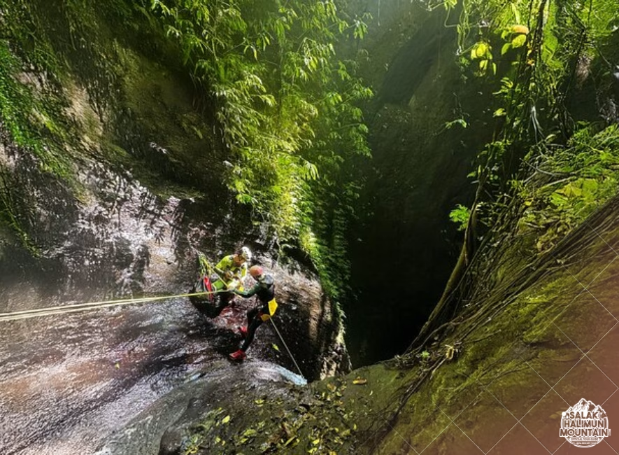
salakhalimunmountain.com – Descending into the deep, sheer-sided jungle canyons of Mount Salak and Halimun National Park plunges you into one of the most challenging navigational environments in West Java. High volcanic basalt walls, towering multi-tiered rainforest canopies, and narrow, twisting river slots routinely block line-of-sight to distant mountain peaks. Even modern GPS receivers often struggle in these wet, vertical corridors, losing satellite locks or exhibiting significant position drift. In these enclosed environments, learning how to use altimeters effectively in jungle canyons turns a simple wrist instrument into your most powerful, reliable navigational lifeline.
Because canyon topography is defined by rapid changes in elevation, an altimeter gives you a continuous vertical coordinate that can be cross-referenced directly with topographic contour lines. Whether you are using a barometric altimeter watch or an independent digital sensor, understanding how barometric pressure, weather shifts, and deep canyon micro-climates affect your readings is essential for accurate route-finding, locating hidden trail exits, and avoiding dangerous dead-end waterfalls.
The Physics of Barometric Altimetry in Humid Corridors
To use an altimeter accurately, you must understand how it measures altitude. Most handheld wilderness altimeters rely on barometric pressure: as you ascend, atmospheric pressure decreases; as you descend into a canyon, atmospheric pressure increases. The device calculates your elevation based on these subtle pressure shifts.
However, atmospheric pressure is not static—it changes constantly with weather patterns and local micro-climates. In tropical mountain environments like Halimun Salak, high humidity, localized heat radiation from damp rock walls, and sudden afternoon cloud accumulation can alter air pressure even if your physical elevation remains unchanged. Recognizing the difference between altitude changes caused by terrain movement and pressure changes caused by incoming weather is the foundation of effective altimeter use.
Calibrating Your Instrument at Known Elevation Anchors
An altimeter is only as accurate as its most recent calibration. Before entering a canyon, calibrate your altimeter at a confirmed elevation point, such as a marked trailhead, a park boundary marker, a mapped river junction, or a known summit benchmark.
Whenever you reach a definitive terrain feature during your trek—such as a major river confluence or a prominent saddle—check your altimeter against the mapped contour elevation for that point. Re-calibrating your device at these known spatial anchors resets any pressure drift that may have accumulated over hours of trekking, ensuring high accuracy when you enter tight slot canyons where visual navigation is impossible.
Combining Altimeter Elevation with Topographic Contour Maps
An altimeter reading alone tells you how high you are above sea level, but it cannot tell you your horizontal position. The true power of an altimeter comes from combining its elevation reading with a detailed topographic map—a technique known as altimeter-contour matching.
Topographic maps represent terrain using contour lines, where each line connects points of equal elevation. If your calibrated altimeter reads 1,150 meters, locate the 1,150-meter contour line on your map. You know with certainty that you are standing somewhere along that specific line. When you are confined inside a narrow canyon or stream valley, your horizontal position is already restricted to the river line itself. Where that river line intersects the 1,150-meter contour line on your map is your exact position.
Locating Hidden Trail Exits and Side Tributaries
Trekking along a canyon floor often requires exiting the riverbed via steep, narrow side paths that climb up onto ridge shoulders. In thick jungle vegetation, these trail exits are notoriously easy to miss, often hidden behind giant tree fern stands or mossy boulder outcrops.
By checking your map beforehand, you can identify the exact elevation where the trail exits the river—for example, at 980 meters. As you hike upstream or downstream, keep an eye on your altimeter. When the display approaches 980 meters, slow down, stop, and thoroughly scan the surrounding canyon walls for machete cuts, worn root steps, or breaks in the vegetation line. Using your altimeter as an elevation trigger prevents you from overshooting crucial trail junctions.
Managing Diurnal Pressure Shifts and Weather Signals
In equatorial regions like West Java, atmospheric pressure follows a predictable daily cycle known as the diurnal pressure tide. Air pressure naturally swells and dips twice a day, typically peaking around 10:00 AM and 10:00 PM, and reaching its lowest points around 4:00 AM and 4:00 PM. This natural cycle can cause an altimeter sitting at a fixed campsite to fluctuate by 10 to 30 meters over the course of a day.
Understanding this phenomenon helps you distinguish between normal daily fluctuations and incoming storm fronts. If your altimeter reading rises significantly while you are resting at a fixed camp—indicating a sharp drop in barometric pressure—a severe rainstorm or atmospheric disturbance is likely approaching. In a jungle canyon, a sudden barometric pressure drop is your early warning signal to move away from low-lying stream beds and seek high ground before flash floods develop.
Accounting for Canyon Trap Effects and Humidity Inversions
Deep, narrow slot canyons can trap dense, cold air masses and moisture layers, creating localized pressure anomalies called micro-inversions. When descending rapidly into a shady, wet gorge, cold air pooling along the riverbed can cause your barometric altimeter to overestimate your descent rate slightly.
To mitigate this effect, give your altimeter a few minutes to temperature-stabilize when transitioning from an exposed, sunlit ridge down into a cold canyon floor. Allowing the internal pressure sensor to adjust to the ambient canyon temperature ensures your elevation readings remain steady and reliable.
Integrating GPS Altimetry with Barometric Sensors
Many modern outdoor watches and handheld devices feature hybrid altimeters that combine barometric pressure sensors with satellite GPS elevation data. While GPS elevation can be imprecise in dense canopy environments, combining both technologies offers distinct advantages.
Use auto-calibration features that allow the device to continuously cross-reference barometric pressure trends with periodic high-confidence GPS satellite fixes when canopy gaps open. However, if satellite signal loss occurs inside a deep gorge, switch your device to manual barometric mode so that localized GPS signal reflection off vertical rock walls does not cause wild elevation spikes on your display.
Building Navigational Confidence in Java’s Canyon Interiors
Mastering altimeter navigation elevates your spatial awareness from guesswork to precise, multi-dimensional tracking. In the deep, shadowy gorges of Mount Salak and Halimun National Park, where the sky is hidden and landmarks are few, your altimeter acts as a constant, objective guide.
By keeping your instrument properly calibrated, matching elevation readings to topographic contours, and staying attuned to barometric weather cues, you navigate tight jungle canyons with total self-reliance, safety, and deep confidence in the wild heart of West Java.
So, if you’re ready to explore the wonders of Mount Salak Halimun, head over to our ONLINE BOOKING PAGE and let’s start planning your adventure. Or simply CLICK THIS LINK to chat with us on WhatsApp.
With our team, you’re not just getting a guide; you’re gaining a local friend who will ensure your trip is nothing short of extraordinary.